Directions

Where is the Grand Canyon?
Grand Canyon is in the northwest corner of Arizona, close to the borders of Utah and Nevada.The Colorado River, which flows through the canyon, drains water from seven states, but the feature we know as Grand Canyon is entirely in Arizona. Most of the Grand Canyon lies within Grand Canyon National Park and is managed by the National Park Service. Jump to a larger map.
Jump to: South Rim ----North Rim

The mile-deep Colorado River creates a
barrier that splits the park into north and south Rims. In this
illustration, the North Rim is shown in yellow and the South Rim is
shown in blue.
Why is the park separated into
South and North Rims?
A 277 mile long (446 km) canyon separates the park into South and
North Rims. The Grand Canyon of the Colorado River is a mile-deep, (1.6
km) and creates a barrier that bisects the park. Even though the average
distance across the canyon is only 10 miles/ 16 km, be aware that it is
a five-hour drive of 215 miles/ 346 km between the park's South Rim
Village and the North Rim Village.South and North Rims?
Scenery, climate and vegetation are noticably different between north and south rims because of differences in elevation. It is almost like having two parks in one and it takes time, planning and effort to be able to visit both sides of the Canyon in one trip.
How Do I Travel to the South Rim?
The South Rim of the Grand Canyon is open all year and is located on the "Arizona" side of the Canyon. The South Rim receives 90% of the park's visitation.The South Rim has an airport and rail service and is close to Interstate 40 and to the transportation centers of Williams and Flagstaff, Arizona. A large city with a major airport, Phoenix, Arizona, is also on this side of the canyon.
South Rim Visitor Center: 36°03'32"N 112°06'33"W
Download the Park Newspaper for the South Rim of Grand Canyon

park newspaper
May 24 - September 3, 2012
South Rim Guide (letter-size)
(Prints on 8.5 x 11" paper 3.3 MB PDF File)
South Rim Guide (tabloid size)
(Prints on 11 x 17" paper 2.3 MB PDF File)
Contains maps, schedules and information. South Rim lodging and camping along with most other visitor services within the park are open all year.
Reserve lodging and campsites as far ahead as possible, especially during busy summer and fall months.
Download the South Rim Village Shuttle Bus and Parking Map
as one large page 22.5 x 17" (735 kb PDF file)
How Do I Travel to the North Rim?
The North Rim of the park is more remote, and has a short season.Visitor Lodging and Food Service is available from mid-May through mid-October.
The North Rim receives 10% of the park's visitation.
The North Rim is located on the "Utah" side of the Grand Canyon and the entrance station is 30 miles south of Jacob Lake on Highway 67. (The actual rim of the Grand Canyon with visitor services is an additional 14 miles south.) There is no airport or rail service to the park. (that means that the North Rim village may only be reached by road).
North Rim Visitor Center: 36°11'51"N 112°03'09"W
Download the Park Newspaper for the North Rim of Grand Canyon

park newspaper
North Rim Guide Newspaper (letter-size)
(Prints on 8.5 x 11" paper 3 MB PDF File)
North Rim Guide Newspaper (tabliod size)
(Prints on 11 x 17" paper 2.5 MB PDF File)
Contains maps, schedules and information. North Rim lodging and camping along with most other visitor services within the park are open from mid-May to mid-October. Reserve lodging and campsites as far ahead as possible.
Download the maps/trail guide as one long page 22.5 x 17"
(945 kb PDF file)

Quick links to information about:
| Lodging | Maps | Shuttle Buses | Guided Tours | Ranger Programs |
| Campgrounds | Food | Public Transport | Mule Trips | Visitor Centers |
| Goods/ Services | Permits | River Trips | Hiking | Sunrise/ Sunset |

is a great way to help Grand Canyon and other areas you visit reduce carbon emissions, divert and reduce what goes into the waste stream, and to generally help the environment. Go to the Traveling Green page for helpful tips on planning your next green adventure.
Thanks for doing what you can to help protect our environment!
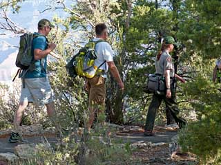
Backcountry Hiking
First time Grand Canyon hikers tend to react to the
experience in one of two ways: either they can't wait to get back, or
they swear they'll never do it again.

Mental attitude and adequate water and food consumption are absolutely essential to the success of any Grand Canyon hike, particularly in summer. The day hiker and the overnight backpacker must be equally prepared for the lack of water, extreme heat and cold, and isolation characteristic of the Grand Canyon.

A hike into the Grand Canyon will test your physical and mental endurance. Know and respect your limitations. Moderation is the key to an enjoyable hike.
Depending on how prepared you are, your trip can be a vacation or a challenge, a revelation or an ordeal.
Backcountry Audio Podcasts
Hike Smart Tips - Audio Podcasts
Backcountry Video: Hiking Grand Canyon, Prepare for Backpacking
Leave No Trace Video
Seasonal updates by Backcountry
Information Center staff covering conditions in the Grand Canyon
backcountry. Learn about water availability, trail conditions, access to
remote trailheads, and weather dangers.
Join Sarah, a PSAR Ranger at Grand
Canyon National Park, to learn about what to expect on the trail, the 10
essentials you should always bring with you (even on a short hike), how
to rescue yourself, some tips for hiking with children and most of all
how to HIKE SMART!
Backcountry Video: Hiking Grand Canyon, Prepare for Backpacking
A Grand Canyon hike can be one of the
most challenging and memorable experiences of a lifetime. But no hike in
the canyon is easy: the terrain is steep, dry and rugged. This video is
designed to help you plan for and enjoy your hike into the canyon's
harsh, yet fragile, environment.
Leave No Trace Video
All Grand Canyon backcountry users are
asked to follow Leave No Trace principles. The goal is to have minimum
human impact on the canyon as a result of your trip. This video will
introduce you to the Leave No Trace principles.
Mule Trips
 North Rim (left)")
|
|
| South Rim mule trips are offered year round. South Rim Mule trips may be booked 13 months in advance and fill up early. A waiting list is maintained for cancellations, but chances of obtaining reservations on the waiting list are slim. If you wish to make a trip into the canyon on a mule, plan ahead! 3 hour Abyss Overlook Ride departs twice daily, through October, and once daily through mid March from the Historic Mule Barn just a short walk from the Bright Angel Lodge. The ride passes through a Ponderosa Forest and a Piñon and Juniper woodland. Riders dismount and walk a short distance to the Abyss, an overlook on the rim of the canyon. $122.81 including tax, per person. Includes a light snack, and water. Overnight Rides stay the night at Phantom Ranch, at the bottom of the Canyon near the Colorado River. This service must be reserved and purchased in advance. Overnight rides include accommodations and meals. Overnight ride prices start at $506.82 for the first person, or two people for $895.11 including taxes. Two-night rides are also available. Check Xanterra's website for more details. Mule rides from the South Rim can be reserved through: Xanterra Parks & Resorts. Call (303) 297-2757 or toll free (888) 297-2757, or FAX (303) 297-3175, or write to: Xanterra Parks & Resorts, 6312 S Fiddlers Green Circle, Suite 600N, Greenwood Village, CO 80111 Visit: www.grandcanyonlodges.com. For waiting list information, call (928) 638-2631 or contact the Bright Angel Lodge transporation desk inside the park. There are restrictions: Overnight mule riders must not weigh more than 200 lbs/91 kg fully dressed 3 hour Abyss Overlook riders must not weigh more than 225 lbs/102 kg.
Riders must be at least 4 feet 7 inches/140 cm in height and must be
able to speak and understand fluent English, must be in good physical
condition, should not be afraid of heights or large animals, and cannot
be pregnant.
|
North Rim mule trips are offered from mid-May to mid-October. North Rim mule trips do not go to the river. One-hour rides along the rim and ½ day rim or inner canyon trips are usually available on a daily basis. Prices start at $40.00/person. 1 Hour Trip - Grand Canyon Rim 7 year age limit - 220 lb. weight limit 8:30 a.m. - 1:30 p.m. $40.00/person, including taxes. 1/2 Day Trip to Uncle Jim's Point 10 year age limit - 200 lb. limit 7:30 a.m. or 12:30 p.m. $80.00/person, including taxes. Inner-Canyon 1/2 Day Trip to Supai Tunnel on the N. Kaibab Trail The 1/2 day ride desends down the North Kaibab Trail 2,300 hundred feet. 10 year age limit - 200 lb. weight limit 7:30 a.m. or 12:30 p.m. $80.00/person, including taxes. Register in the lobby of the Grand Canyon Lodge at the Grand Canyon Trail Rides desk; open 7:00am-5:00pm daily. Shuttle bus to trail head leaves the lodge one half hour before trip departure times. For reservations call Grand Canyon Trail Rides, (435) 679-8665, or write to: Grand Canyon Trail Rides PO Box 128, Tropic, Utah, 84776, or visit them at canyonrides.com |
National Forest Trail Rides - South Rim
One-hour and two-hour trail rides through the pines of the Kaibab National Forest and twilight campfire and wagon rides are available. Both horses and mules are utilized. Apache Stables is located just outside of the South Entrance to Grand Canyon National Park at the north end of the community of Tusayan. For information and reservations call (928) 638-2891.
One-hour and two-hour trail rides through the pines of the Kaibab National Forest and twilight campfire and wagon rides are available. Both horses and mules are utilized. Apache Stables is located just outside of the South Entrance to Grand Canyon National Park at the north end of the community of Tusayan. For information and reservations call (928) 638-2891.
| Lodging | Food | Goods/ Services | Newspapers | Ranger Programs |
| Campgrounds | Maps | Transportation | Guided Tours | Sunrise/ Sunset |
River Trips / Permits

1 Day Commercial River Trips - Half-day and full-day smooth water trips on the Colorado River.
2 to 5 Day Noncommercial River Trips - Noncommercial trips that launch from Diamond Creek and takeout at Lake Mead typically are 2 to 5 days in length. Permits for these whitewater trips are available to the public starting one year in advance and are distributed on a first-come first-served basis.
Lees Ferry to Diamond Creek River Trips (commercial and noncommercial) - Motorized and non-motorized whitewater rafting trips which launch from Lees Ferry and take-out at Diamond Creek vary greatly in length. Motor trips usually take a minimum of 7 days to reach Diamond Creek, but half trip options are available for those who wish to hike in or out at Phantom Ranch. Individuals can choose between commercial and noncommercial trips.
- 3 to 18 Day Commercial River Trips. These are professionally guided raft trips, available to the public and often reserved a year or two in advance.
- 12 to 25 Day Noncommercial River Trips. These are self-guided raft trips, sometimes referred to as private river trips. Permits for these trips are made available to the public through a weighted lottery.

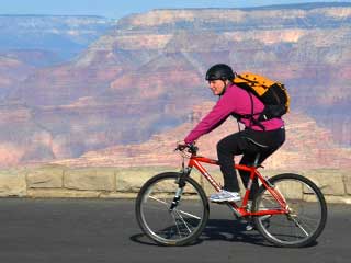
South Rim Fitness Opportunities
Fitness opportunities abound on the South Rim of Grand Canyon
National Park. There are activities for every fitness level and every
visitor, from short walks on paved trails to strenuous backcountry
hiking adventures.
Before engaging on your fitness adventures please consider that the South Rim of Grand Canyon averages 7,000 feet / 2,134 meters above sea level. Visitors with respiratory or heart problems may experience difficulties. Walking, hiking, and exercising at this elevation is strenuous, your normal fitness level may not coincide with your fitness level at the park. Please use caution when engaging in any physical activities. Plan for extreme heat when hiking into the canyon in summer.
Before engaging on your fitness adventures please consider that the South Rim of Grand Canyon averages 7,000 feet / 2,134 meters above sea level. Visitors with respiratory or heart problems may experience difficulties. Walking, hiking, and exercising at this elevation is strenuous, your normal fitness level may not coincide with your fitness level at the park. Please use caution when engaging in any physical activities. Plan for extreme heat when hiking into the canyon in summer.

Visitors at Mather Point, South Rim, Grand Canyon National Park
Some fitness activity suggestions:
Fitness Includes:
| Healthy Parks, Healthy People | Calorie Counter |
| Dietary and Fitness Tools | Hiking Tips - Hike Smart |
Grand Canyon Active Trails Program
A grant from the National Park Foundation and the Grand Canyon Association has enabled the team to purchase incentives to encourage widespread participation in these events.

Grand Canyon Sunrise
The Next Grand Canyon Active Trails Event:
5 Mile round-trip (8 km) Sunrise Walk
From South Kaibab Trail Parking Lot
to Shoshone Point on a new trail.
Monday, July 23rd
Meet at South Kaibab Trailhead - 5:00 a.m.
(Transportation to Trailhead is not provided)
5 Mile round-trip (8 km) Sunrise Walk
From South Kaibab Trail Parking Lot
to Shoshone Point on a new trail.
Monday, July 23rd
Meet at South Kaibab Trailhead - 5:00 a.m.
(Transportation to Trailhead is not provided)
On Monday, July 23, 2012, the Team will lead a 5-mile
round trip walk along the rim between South Kaibab Trailhead and
Shoshone Point. This hike will begin at 5:00 A.M. at the South Kaibab
Trailhead. Transportation to the trailhead is not provided. Views along
this newly created trail at sunrise will be spectacular.
Be prepared with water, snacks, appropriate clothing and footwear. Headlamps and flashlights are recommended since the walk starts 30 minutes before sunrise. Family, friends, and visitors are welcome. Children must be accompanied by an adult. Participation is free and door prizes are plentiful...
Email the Active Trails Team or call (928) 638-7088 for information on this event or equipment concerns. You can also friend 'Grand Canyon Active Trails' on Facebook!
This walk is sponsored by Grand Canyon Active Trails, a community based recreation program that fosters a positive and supportive exercise experience while making use of extensive walking and bike trails that exist at Grand Canyon National Park.
Hope to see you there!
Tentative Schedule of 2012 Active Trails Events
|
|
Walks
 |
Bike Rides
 |
July 23
S. Kaibab Trailhead to Shoshone Point. |
|
August 20
|
August 6
|
September 17 (Wilderness Month)
|
September 3 (Wilderness Month)
|
October 15
|
September 29 (Public Lands Day)
|
October 29 (Season Finale)
|
|
Available Fitness Activities: Grand Canyon National Park
WARNING:
The South Rim of Grand Canyon averages 7,000 feet / 2,134 meters above sea level. Visitors with respiratory or heart problems may experience difficulties. Exercising at this elevation can be strenuous. Please use caution and when engaging in any physical activities and use care not to push yourself. Always check the weather before exercising outside.
The South Rim of Grand Canyon averages 7,000 feet / 2,134 meters above sea level. Visitors with respiratory or heart problems may experience difficulties. Exercising at this elevation can be strenuous. Please use caution and when engaging in any physical activities and use care not to push yourself. Always check the weather before exercising outside.
-

(Video) Explore & Exercise on the Rim Trail (03:29)
The Rim Trail along the South Rim of the Grand Canyon provides a great way to get some exercise while out exploring 13 miles of multi-use pathway.
- Credit/ Author:
- Brandon Torres
- Date created:
- 2011-10-03

NPS photo by Mike Weaver
Active Trails 2012 Opener Participants
was assembled by long-time community resident, Park Ranger Michael Weaver, and includes Park Rangers Chris Carroll, and Jennifer Onufer.
Email the Active Trails Team or call (928) 638-7088 for information.
You may also friend "Grand Canyon Active Trails" on Facebook.
Cell Phone Audio Tours

When visiting Grand Canyon National Park you can listen to these narrations at numerous points of interest on the South Rim from Hermit Road to Yaki Point. Just look for the “Park Ranger Audio Tour” signs, call 928-225-2907, and enter the stop number.
Since this is a phone tour, you can be anywhere along the rim where there is cell phone coverage to listen to the messages. Feel free to stroll along the rim as you listen, then stop and enjoy the view to reflect on what you have just learned.
There is no additional charge to listen to these messages.
Please be aware that cell phone coverage at Grand Canyon can be spotty and not all providers offer service in the park.
We are very interested in hearing your feedback about this audio tour and we encourage you to leave a message about your experience with this program. You can do this by pressing *0 on your cell phone at anytime while listening to any portion of your tour.
Here are some helpful instructions when you are listening to these audio tours:
Press 1 to Rewind
Press 2 to Pause/Play
Press 3 to Fast Forward
Press # to Stop
Press *0 to Leave Comments
You can also download the audio tour files onto your MP3 player or iPhone.
Go to this OnCell Systems web page and follow the instructions.
This program is funded by the Grand Canyon Association.
If you would like to listen to the Park Ranger Audio Tours while at home, here is a list of the tour numbers. The transcripts for some of the tours are provided in PDF file format.
After dialing 1-928-225-2907
you will hear the Audio Tour Introduction with Ranger Judy (PDF 11KB)
Then press stop number:
1 - Yaki Point with Ranger Lori (PDF 11KB)
2 - South Kaibab Trail with Ranger Krystina (PDF 11KB)
3 - Geologic Clock with Ranger Haley (PDF 12KB)
4 - Night Skies with Dr. Tyler Nordgren
5 - Mather Point with Ranger David (PDF 12KB)
6 - Native Americans with Ranger Lisa (PDF 11KB)
7 - Air Quality with Ranger Haley (PDF 15KB)
8 - Night Skies with Dr. Tyler Nordgren
9 - Shiva Temple with Ranger Haley (PDF 11KB)
10 - Grand Canyon Village with Ranger Judy (PDF 12KB)
11 - Civilian Conservation Corps with Ranger Bob (PDF 12KB)
12 - Bright Angel Lodge with Ranger Judy (PDF 11KB)
13 - Condors with Ranger Pat (PDF 12KB)
14 - Original People (Kolb Studio) with Ranger Shanna (PDF 44KB)
15 - Mule Corral with Ranger Andrea (PDF 11KB)
16 - Trailview Overlook with Ranger Judy (PDF 12KB)
17 - Geologic Clock with Ranger Haley (PDF 12KB)
18 - John Wesley Powell with Ranger Jennie
19 - Trail of Time East with Ranger Judy
20 - Trail of Time West with Ranger Judy
21 - Historic Village Part 1: Depot
22 - Historic Village Part 2: Depot
23 - Historic Village Part 3: Old Superintendent's House
24 - Historic Village Part 4: Old Hospital
25 - Historic Village Part 5: Ranger Operations
26 - Historic Village Part 6: Community Building
27 - Grand Canyon Lodge (North Rim) (PDF 13KB)
28 - Geology at Bright Angel Point (North Rim) with Ranger Jaime (PDF 13KB)
29 - Roaring Springs (North Rim) with Ranger Robin (PDF 12KB)
30 - Night Skies (North Rim) with Dr. Tyler Nordgren
Historic Kolb Studio Art Exhibits

Those
|

At first glance, Kolb Studio
is just a house perched on the rim of the Grand Canyon, but, if you
look behind the doors or see it from the Bright Angel Trail after a long
hike from the river, you realize it is much more than that.
Kolb Studio is the place where the Kolb Brothers created a lasting legacy of adventure, family love, and amazing Grand Canyon photography that will last as long as the Canyon itself.
Open Daily 8:00 a.m - 8:00 p.m. (summer hours)
View the exhibit panels here...
Kolb Studio is the place where the Kolb Brothers created a lasting legacy of adventure, family love, and amazing Grand Canyon photography that will last as long as the Canyon itself.
Open Daily 8:00 a.m - 8:00 p.m. (summer hours)
View the exhibit panels here...
This exhibit about the Kolb Brothers happens to coincide with the 100th anniversary of
"the Big Trip;" their famous 1912 river trip, and Arizona's statehood centennial.
The goal of this exhibit is to share their stories with the thousands of park visitors who will visit Kolb Studio, allowing them the opportunity to view the Grand Canyon through the eyes and camera lens of the Emery and Ellsworth. There is more to learn about their adventures on the Colorado River, including screenings of their motion picture that remains a box office hit - showing for more than sixty years in the auditorium/gallery at Kolb Studio.
Through
the years, the KoIb Brothers have inspired visitors from around the
world with their sense of wonder brought about through their connection
to the Grand Canyon.

Grand Canyon Celebration of Art: "Plen
Air on the Rim" September 8-12, 2012 -- Exhibition & Art Sales
September 14 - November 25, 2012
2012 Grand Canyon Celebration of Art (South Rim)
September 8 - November 25, 2012
Hosted each year by the Grand Canyon Association, the Grand Canyon Celebration of Art is an annual event that includes 6 days of art related events followed by a month long exhibition in Kolb Studio on the South Rim of Grand Canyon National Park. .
The Celebration of Art features thirty artists from around the country who engage in a plein air competition and exhibition. Park visitors have the opportunity to watch the artists paint as they seek to represent the shifting light and shadow, amazing land forms, and vibrant colors of this vast landscape. .
Each artist brings a completed studio piece with them and then creates more artwork on site during the "Plein Air on the Rim" and Quick Draw events that takes place in the historic district of Grand Canyon Village. During the auction that follows the Quick Draw event on September 14, 2012, park residents and visitors have the opportunity to bid on the work and to bring a piece of Grand Canyon home.
Proceeds from this event will support the goal of funding an art venue at the South Rim of the Grand Canyon. This permanent home will ensure that future generations of park visitors will be able to view the stunning art collection in the Grand Canyon National Park Museum and Grand Canyon Association Collections.
For more information about the 2012 Celebration of Art visit: http://www.grandcanyon.org/celebration_eventschedule.asp
View photos from the 2011 Celebration of Art here...

Kolb Studio on the Rim
Once the home and business of the Kolb brothers, pioneering photographers and filmmakers at Grand Canyon, this rambling, Victorian era building (1905) has been restored to its original splendor.
Visit the free Kolb Brothers exhibit, A Grand Life at the Grand Canyon in the auditorium, and shop in the bookstore. This fall, the 4th Annual Grand Canyon Celebration of Art Exhibit will be showcased here between September 8 and November 25, 2012.
Kolb Studio is located in the Village Historic District at the Bright Angel trailhead.
Open daily 8:00 a.m. - 8:00 p.m. (summer hours)
Other Visitor Centers

South Rim Village Transit Map
(1 MB PDF File) letter-size paper - 4 pages
as one large page 22.5" x 17"
(735 kb PDF file)
Exhibits at Kolb Studio are sponsored by the Grand Canyon Association and Grand Canyon National Park.
For more information on this exhibit and the Grand Canyon Association and its programs, please visit http://www.grandcanyon.org
Visitor and Information Centers
Jump to: Desert View North Rim
The South Rim and Desert View (open all year)
|


Campgrounds

This page has information about "developed" campgrounds. (where vehicles are permitted)
For information about backpacking and camping within the canyon, visit this link. How Can I Make Campground Reservations ?Campground reservations can be made for two of the campgrounds within Grand Canyon National Park: (one on each rim)
by calling 1-877-444-6777 or online at http://www.recreation.gov/ Reservations can be made up to 6 months in advance.
How Do I Decide Which Rim to Visit ?
| ||||||||||||||||||||


| Quick links to more information about: | ||||
| Lodging | Maps | Shuttle Buses | Guided Tours | Ranger Programs |
| Campgrounds | Food | Public Transport | Mule Trips | Visitor Centers |
| Goods/ Services | Permits | River Trips | Hiking | Sunrise/ Sunset |
The mile-deep Colorado River creates a
barrier that splits the park into north and south Rims. In this
illustration, the North Rim is shown in yellow and the South Rim is
shown in blue.
Why is the park separated into South and North Rims?
A 277 mile long (446 km) canyon separates the park into South and
North Rims. The Grand Canyon of the Colorado River is a mile-deep, (1.6
km) and creates a barrier that bisects the park. Even though the average
distance across the canyon is only 10 miles/ 16 km, be aware that it is
a five-hour drive of 215 miles/ 346 km between the park's South Rim
Village and the North Rim Village.Scenery, climate and vegetation are noticably different between north and south rims because of differences in elevation. It is almost like having two parks in one and it takes time, planning and effort to be able to visit both sides of the Canyon in one trip.
Toroweap/Tuweep Area
Jump to the current weather for the Toroweap/Tuweep area.
Your Visit - Trails - Map - Geology - Brochure Download
Your Visit - Trails - Map - Geology - Brochure Download

View upriver from Toroweap Overlook.
3000 vertical feet above the Colorado River, is breathtaking; the sheer drop, dramatic! Equally impressive are the volcanic features, cinder cones and lava flows, which make this viewpoint unique in Grand Canyon National Park. Renowned Lava Falls Rapid is just downriver and can easily be seen and heard from the overlook.
Toroweap, a Paiute term meaning "dry or barren valley," refers to many local features, including the geologic formation and fault, the valley, and the overlook. Tuweep came into use to describe the local white settlement and later the park district. Tuweep in Paiute refers to "the earth," but this place name may be derived from a longer Paiute word meaning "long valley."
A visit to this area can be challenging, but rewarding. Since the National Park Service manages the area for its primitive values, improvements and services are minimal.
Getting There
The Bureau of Land Management Arizona Strip Visitor Maps are sold at the Arizona Strip Information Center in St. George, Utah, at nearby Pipe Spring National Monument, and at the Kaibab National Forest office in Fredonia, Arizona.
The area can be reached from Arizona Highway 389 near Fredonia or Colorado City, Arizona, or from St. George, Utah.
- Sunshine Route (BLM road #109), the primary access route, leaves Highway 389 about seven miles/12km west of Fredonia. (6 miles east of Pipe Springs NM) It is 61 miles /100 km long and is the most reliable route, but is subject to washboarding and dust.
- Clayhole Route (BLM Road #5) leaves Highway 389 at Colorado City. It is also about 60 miles /100 km long, but may be impassable when wet.
- Main Street Route (BLM Roads #1069 and #5) from St.
George is about 90 miles/145 km long and is the most scenic route. It
may be impassable in winter due to snow on the slopes of Mt. Trumbull.
- Winter Travel December through March these roads,
including the main Sunshine Route, become muddy and impassable when
covered by melting snow. Travel may be possible when the road surface
freezes at low temperatures (below 20°F /-7°C) but roads become
impassible again as the temperature rises. During the winter, roads
often are passible only between 4:00 a.m. and 8:00 a.m., if at all. Click here for current Tuweep temperature.
All routes are secondary county roads, graded occasionally, and generally in fair condition. Dust wallows several feet deep may appear during dry periods. The last three miles across the slickrock are the roughest, requiring a high clearance vehicle (above right). Allow two to three hours travel time from the highway to the overlook. RVs, trailers, or low-clearance vehicles are not recommended. All routes may be impassable after heavy rains and are subject to flash flooding. Twenty-five percent of visitors experience one or more flat tires. Dangerous curves are often unmarked, and posted mileages may be inaccurate. Cell phone coverage is spotty or nonexistent in this area. Since there are few, if any, year-round residents, assistance is not guaranteed on any route. For these reasons, no one should attempt the trip without ample preparation and knowledge of the hazards associated with remote desert travel. Travelers should carry:
• Extra water, food, and gasoline;
• Good tires including at least one usable spare;
• and parts, tools, and knowledge to handle vehicle and tire repairs including tire plugs and a portable air compressor.A tow costs $1,000 – $2,000.
Your Visit
Recreation: Tuweep, accessible year-round, is managed for its undeveloped recreational experiences: solitude, natural history exploration, photography, camping, and limited hiking. Trails in the campground area are relatively easy. The Lava Falls Route down to the river is extremely rough, steep, and exposed to the sun. It drops 2,500 feet over its 1.5 mile length down to the Colorado River and is poorly marked. The Tuckup Trail is mostly flat to Tuckup Canyon, but has few water sources. It, too, can be difficult to follow.Fees: There is no charge for campground or day-use. A permit and fee are required for backcountry camping.
Campground: Camping is allowed only in the Tuweep Campground within the Toroweap/Tuweep vicinity. Nine primitive sites (sites 1-9) for up to six people and two vehicles are available on a first-come, first-served basis. (below) Camping is free. Sites may fill during spring months and during holidays and weekends. Picnic tables, fie grates, and composting toilets are provided. Bring your own water and firewood. Collecting firewood or kindling from the national park is strictly prohibited.
One group site (Site 10) for 7–11 people and up to four vehicles is available via reservation only up until noon the day it is needed. The group site may be reserved, free of charge, up to four months in advance Submit an email request here.
Ravens, mice, skunks, and ringtails are common. Always store your food, scented items, and trash securely or in your vehicle when leaving your campsite unattended.
Backcountry Camping: Permits are required for backcountry camping and can be obtained at Pipe Springs National Monument (near Fredonia, AZ), the Arizona Strip Information Center in St. George, UT, or from Grand Canyon National Park's Backcountry Information Center. Online reservations are not available but you may email the Backcountry Information Center for further information or call (928) 638-7875, 1 to 5 p.m., Monday to Friday, MST. Backcountry camping is zone based in the Tuweep sub-District of Grand Canyon which stretches from Kanab Creek to the Grand Wash Cliffs.
Services: No gas, food, water, lodging, garbage collection, or other services are provided. A National Park Service ranger is stationed here year-round, but may not always be available. There is NO telephone available or reliable cell coverage at Toroweap.
Airstrip: The State of Arizona has closed the Tuweep Airstrip.
Grand Canyon National Park Regulations:
Visitors are responsible for knowing and following all park regulations. These include:
- Collection and/or Disturbance of Natural and Archeological Resources Prohibited
- Collection of any Firewood Prohibited
- Vehicles Must Stay on Open Roadways and in Parking Areas
- OHVs (ATVs, Dirtbikes, UTVs, etc.) MUST be Highway/Street Legal. (Arizona requires MC plates - RV plate not valid.)
(Utah plate required - Utah registration stickers not valid.)
- Camping Permits Required (Except at Tuweep Campground)
- Campfires Prohibited (Except at Tuweep Campground)
- Pets Must Be Restrained and are Prohibited Off-Roadway and within the Inner Canyon
- All Hunting Prohibited
- Firearms Restricted
- Please walk on durable surfaces (established trails, slickrock, and routes) as the soil is a living biological crust and is damaged for decades by a single footstep.
- Use caution near the canyon rim and do not throw anything over the rim.
Toroweap Trails
The hiking routes in the Toroweap area require navigational ability as
they are sparsely marked with cairns. Self-rescue is the only dependable
option available in the event of an injury or illness. Shade and water
are scarce; heat exhaustion is common. All trails are closed to pets,
bicycles, and vehicles.
The Tuckup Trail begins on the Tuckup Road, 5.3 miles /
8.5 km south of the park boundary. Use the parking area 0.1 mile / 0.2
km after the left turn onto the Tuckup Road. The first 2 miles/3.2 km,
an old jeep road, is the area’s best day hike. After this section, the
trail is difficult to follow, requiring route-finding skills. Hikers use
this trail for either a multi-day hike (permit required) or as an out
and back hike. Bring adequate water for this sun-exposed trail.
The Saddle Horse Canyon Trail is a 1.6 mile / 2.6 km,
round trip hike (1 hour). The trail starts 0.3 mile / 0.5 km south of
the Tuweep Campground (6.3 miles / 10.2 km south of the park boundary).
This easy walk requires some route finding (follow the cairns) and
brings you to the rim of Saddle Horse Canyon.
The Vulcans Throne Route provides a challenging 1,000
foot / 300 m ascent up the cinder-covered slopes of a volcanic cone,
rewarding hikers with a dramatic view of the expansive esplanade and
distant Shivwits Plateau. Park at the south end of the Vulcans Throne
spur road and look to the east for the faint trail. This short hike,
less than a mile, gains significant elevation. A register marks the top
(go past the first “false” summit).
The Esplanade Loop Trail starts from Tuweep Campground
Site 10. This easy walk of 2.9 miles / 4.7 km (1 – 2 hours) requires
some navigational skill; watch for the cairns. Follow the two-track road
to the old Tuckup Road. Upon reaching the Tuckup Road, turn left (west)
and walk until you reach the Tuckup Trailhead. At the trailhead follow
the main road south to the Tuweep Campground completing your loop.

Toroweap Vicinity Map

The geologic history of the Tuweep area is similar to the rest of Grand Canyon, but includes a more recent chapter of volcanism. The Toroweap Fault underlies the valley, crosses the Colorado River, and continues south up Prospect Canyon. Volcanic activity began along this fault around seven million years ago. Over time lava issued from more than 60 vents. Beginning about 1.2 million years ago some flowed into Toroweap Valley, forming the flat-bottomed valley we see today. Vulcans Throne, Mount Trumbull and the Uinkaret Mountains are other features that are the result of volcanic activity.
Download Geology of the Tuweep Area Bulletin (2 pages 102kb PDF file)
More than a dozen times, lava spilled over the canyon rim, damming the Colorado River. Remnants of these flows and dams are easily visible just west of the overlook. Sediments clinging to the canyon walls high above the river indicate the formation of large lakes. The river eroded the lava dams and continued its downward cutting. It is now 50 feet (15 m) deeper than the base of the dams. Despite its name, Lava Falls Rapid was formed from debris washed down Prospect Canyon, not from remains of the lava flows.
It is less than one mile across the canyon to the Hualapai Indian Reservation on the South Rim, making this one of the narrowest and deepest segments of the inner canyon. The colorful redrock of the Hermit Shale and Supai sandstones to the east contrasts with the black, basaltic lava flows to the west, making Toroweap Overlook a memorable, and often-photographed, viewpoint in Grand Canyon.
Ecology
Tuweep sits at an elevation of 4600 feet (1400 m) on a landform known as the Esplanade which forms a flat shelf situated about halfway between the coniferous forests of the North Rim and the hot canyon bottom. This is a high desert area with mild winters and light snows. Summers are hot with thunderstorms from July to September.
In Toroweap Valley a chaparral community exists with juniper and pinyon pines, sagebrush and saltbush, Mormon tea and other woody shrubs, and various grasses. Nearer the Esplanade succulent cacti, yucca, and agave predominate. In years of abundant winter moisture, wildflowers may proliferate. Some life forms, like the crusty black "cryptobiotic" soil, are rare and sensitive. Please avoid stepping on these fragile living organisms.
Wildlife includes coyotes, mule deer, jackrabbits, rodents, and numerous species of birds and reptiles. An often-overlooked and little-understood biotic community exists seasonally in the slickrock water pockets on the Esplanade. Fairy and horseshoe shrimp, tiny frogs, and microscopic organisms emerge from the muddy bottom when moisture fills these pools for sufficient periods of time. The desert is truly a beautiful and amazing place to those who take the time to explore and study it.
Human History
The first humans in the Tuweep region were likely ice-age hunters who lived a nomadic hunting-gathering existence in what was a milder climate. The Ancestral Puebloans farmed in this area, arriving about 2000 years ago and migrating eastward around A.D.1300. The most recent American Indian group to live here is the Paiute, who have a reservation to the north. Evidence of past human presence in this region includes dwellings, rock art, and numerous lithic/artifact sites.
John Wesley Powell visited Tuweep in 1870 while unsuccessfully searching for missing members of his 1869 river expedition. He mapped and named many of the local features. More recently, European-Americans ranched, mined, and settled in the area. While ranchers used this valley seasonally in the early 1900s, the first year-round homestead was the Lower Kent Ranch, built in 1927, located just north of the park. Other pioneers in the region included the Schmutz, Cunningham, Craig, and Bundy families. Henry Covington herded sheep and mined on the Esplanade off and on for over 20 years. There are still many sites that speak of his determination to live and prosper in this arid region.

Julie russell, NPS
Park Ranger John Riffey
in 1975. One of the best known residents of the area was Tuweep ranger John Riffey, who worked here for 38 years. His helpfulness, longevity, and airplane ("Pogo") contributed to his legendary status.
Today, the area is managed for preservation of the abundant natural and cultural resources and for the enjoyment of the few who venture to this remote corner of the Grand Canyon.
Toroweap - Tuweep |
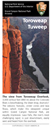 |
Toroweap - Tuweep (498 kb PDF file) revised Jan. 2011 The View from Toroweap Overlook, 3000 vertical feet above the Colorado River, is breathtaking; the sheer drop, dramatic! Equally impressive are the volcanic features, cinder cones and lava flows, which make this viewpoint unique in Grand Canyon National Park. A visit to this remote area can be challenging, but rewarding. Since the National Park Service manages the area for its primitive values, improvements and services are minimal. |
Hermit Road
Jump to photos from the Hermit Road Overlooks
Hermit Road is a scenic route along the west end of Grand Canyon Village on the South Rim which follows the rim for 7 miles (11 km) out to Hermits Rest. This extremely popular route is accessed by free park shuttle bus, foot, bicycle, or commercial bus tour most of the year, with private vehicles allowed only during winter months of December, January and February.
Along the rim are nine designated viewpoints where the free Hermits Rest Route shuttle bus stops. The Rim Trail also follows the rim of the canyon for 7.8 miles (12.6 km) along Hermit Road and offers the opportunity for short or long walks between viewpoints on both paved and dirt trails. In addition to the Rim Trail, three miles of paved greenway trail provide additional views for cyclists and hikers.

Between March 1st and November 30,
Hermit Road buses provide transportation between the Village Route
Transfer Station and Hermits Rest (7 miles/ 11 km) with stops at 9
canyon overlooks. On the Return Trip, buses stop only at Hermits Rest,
Pima, Mojave, and Powell Points. The Hermit Road (Red Route) is a 75
minute round-trip ride (without getting off the bus).
NPS Map

Between March 1st and November 30th,
free shuttle buses provide transportation between the Village Route
Transfer Station and Hermits Rest (7 miles/ 11 km) with stops at nine
canyon overlooks. On the return trip, buses stop only at Hermits Rest,
Pima, Mohave, and Powell Points.
Shuttle bus stops on Hermit Road. Service from March 1 - November 30 each year.
Touring the Scenic Hermit Road - Audiocast, (January 30, 2009)
Duration 4:56 - By Park Ranger Brian Gatlin - Play
Download the Transcript (19kb PDF File) Hermit Road Podcast
Download link (3.95MB MP3 File) cut and paste this link into your media player:
Download link (3.95MB MP3 File) cut and paste this link into your media player:
http://www.nps.gov/grca/photosmultimedia/upload/20090130hermit.mp3
Photos From the Hermit Road Overlooks

Boarding Hermit Road Shuttle
0.7 miles, 1.1 km west from here to Trailview Overlook on paved trail
The Hermits Rest Route (Red) shuttle begins here.
The Rim Trail also begins here. From the transfer station, the trail climbs a hill to Trailview Overlook. The hill was created by the Bright Angel Fault, and is one of the steepest sections of the Rim Trail. But the views along the way are worth the climb!

NPS/Marge Ullmann
View of top section of Bright Angel Trail and Historic District from Trailview Overlook.
0.7 miles, 1.1 km west from here to Maricopa Point on paved trail
0.7 miles, 1.1 km east from here to Hermits Rest Transfer on a paved trail
This viewpoint offers good views of the Bright Angel Trail switchbacking through the canyon below, as well as the Historic District of the village, including the prominent El Tovar Hotel. Several sets of stairs access two main viewing areas.

NPS/Marge Ullmann
View to the east from Maricopa Point.
0.5 miles, 0.8 km west from here to Powell Point on paved and then dirt trail
0.7 miles, 1.1 km east from here to Trailview Overlook on a paved trail
In addition to stunning vistas, Maricopa Point looks out over the former Orphan Lode Mine, claimed in 1891 by miner Dan Hogan. Originally mining copper, Hogan switched to uranium ore in the 1950s. Mining operations ended in 1967. Grand Canyon National Park acquired the property in 1987 but only began major environmental restoration in 2008.

NPS/Marge Ullmann
Powell Memorial
0.3 miles, 0.5 km west from here to Hopi Point on dirt trail
0.5 miles, 0.8 km east from here to Maricopa Point on dirt and then paved trail
The Powell Memorial at this viewpoint commemorates the 1869 and 1871-72 exploratory trips down the Colorado River by Major John Wesley Powell and expedition crews. Stunning vistas can also be enjoyed from Powell Point.

NPS/Marge Ullmann
View looking across at the North Rim from an upper tier of Hopi Point.
0.8 miles, 1.3 km west from here to Mohave Point on dirt trail
0.3 miles, 0.5 km east from here to Powell Point on dirt trail
Hopi Point is one of the most popular viewpoints for watching the sunset and sunrise because of its wide vistas. The Colorado River comes into view to the west. Restrooms are available here.

NPS/Marge Ullmann
View to the west of Mohave Point.
1.1 miles, 1.8 km west from here to The Abyss on dirt trail
0.8 miles, 1.3 km east from here to Hopi Point on dirt trail
Another spectacular point for watching sunset and sunrise, Mohave Point also offers views of the Colorado River deep in the canyon below.

NPS/Marge Ullmann
Looking down into Monument Creek drainage from The Abyss.
0.9 miles, 1.4 km west from here to Monument Creek Vista on dirt trail
1.1 miles, 1.8 km east from here to Mohave Point on dirt trail
This viewpoint provides an almost vertical view down into the canyon, looking down into the Monument Creek drainage area where backpackers often camp next to Monument Creek or on a small beach along the Colorado River at Granite Rapids.

NPS/Marge Ullmann
Looking down into Monument Creek drainage from Monument Creek Vista.
1.7 miles, 2.7 km west from here to Pima Point on paved trail
0.9 miles, 1.4 km east from here to The Abyss on dirt trail
From this viewpoint the Greenway Trail begins, accommodating hikers, bicyclists, and visitors using wheelchairs. The trail meets Accessibility Guidelines for Outdoor Developed Areas. Much of the trail follows the 1912 alignment of Hermit Road. There are six overlooks, including Pima Point, in addition to multiple resting areas along the trail.

NPS/Marge Ullmann
View of Colorado River to the west from Pima Point.
1.1 miles, 1.8 km west from here to Hermits Rest on paved trail
1.7 miles, 2.7 km east from here to Monument Creek Vista on paved trail
Pima Point is one of the best places on the rim to see and sometimes hear the river. The splash and grind of Granite Rapids below can be heard echoing up the canyon walls on quiet days. The Greenway Trail continues from here to Hermits Rest, allowing bicyclists and visitors using wheelchairs to share the path with pedestrians.

NPS/Marge Ullmann
Hermits Rest
Rim Trail ends to the west
1.1 miles, 1.8 km east from here to Pima Point on paved trail
Mary Colter, one of Grand Canyon's most famous architects, built Hermits Rest in 1914 to look like an old miner's cabin, complete with a giant fireplace and front porch. Today Hermits Rest has a gift shop and small snack bar. Restrooms are available here. The Hermit Trail, winding steeply down into the canyon, begins about 0.5 miles, 0.8 km west of Hermits Rest.

NPS/Marge Ullmann
Metal cages protect young plants from browsing animals.
To learn more about the 2008 Hermit Road Rehabilitation Project go to The Scenic and Historic Hermit Road.
The project also included one of the largest vegetation restoration and rehabilitation efforts ever undertaken at Grand Canyon National Park. Restoration crews planted 20,000 plants and spread 200 pounds of native grass and shrub seed.
The vegetation work stabilized road shoulders, maintained the genetic integrity of plant species along Hermit Road, replanted impacted areas, and continues today with invasive species management and routine maintenance.
To learn more about the revegetation project go to Canyon Sketches Vol 06 - October 2008 Hermit Road Native Plant Restoration.
Desert View Drive
Desert View Drive
is a scenic route to the east of Grand Canyon Village on the South Rim
which follows the rim for 25 miles (40 km) out to the Desert View
Watchtower and East Entrance. Along the way, six developed canyon
viewpoints, four picnic areas, and five unmarked pullouts are accessible
with private vehicles, in addition to the Tusayan Ruin and Museum.
The Desert View services area includes the Watchtower and gift shop, trading post and snack bar, visitor center/bookstore, marketplace, service station, campground, and restrooms.
Download the Desert View Drive map (359kb pdf file) as shown below.
The Desert View services area includes the Watchtower and gift shop, trading post and snack bar, visitor center/bookstore, marketplace, service station, campground, and restrooms.
Download the Desert View Drive map (359kb pdf file) as shown below.


NPS/Marge Ullmann
View from Pipe Creek Vista.
Pipe Creek Vista
This pullout can be accessed by private vehicle or by using the free Kaibab Rim Route (Orange) Shuttle Bus, departing from the Grand Canyon Visitor Center.
The Canyon Rim Trail may be accessed here, with a 1.3 mile / 2.1 km walk on a paved trail west to Mather Point, or a 0.8 mile / 1.3 km walk east to the South Kaibab Trailhead.

NPS/Marge Ullmann
View from Yaki Point of O'Neill Butte below Cedar Ridge on the South Kaibab Trail.
(Elevation: 7262 feet / 2213 meters)
Yaki Point is the only viewpoint on Desert View Drive that is not accessible with a private vehicle. It can be reached using the free Kaibab Rim Route (Orange) Shuttle Bus departing from the Grand Canyon Visitor Center.
Yaki Point is a quiet place from which to enjoy sunset or sunrise.

NPS/Marge Ullmann
View to the west from Grandview Point.
(Elevation: 7399 feet / 2256 meters)
This popular viewpoint offers panoramic views of Grand Canyon from east to west, including several bends of the Colorado River to the east.
The historic Grandview Trail begins here. This trail is VERY steep! In the summer much of the trail is in full sun. In the winter ice and snow can make hiking treacherous. Always use caution on the Grandview Trail.

NPS/Marge Ullmann
The Colorado River is a prominent feature below Moran Point.
(Elevation: 7160 feet / 2182 meters)
Geology is a prominent feature at any Grand Canyon viewpoint but at Moran Point three main rock groups are clearly visible.
The Layered Paleozoic Rocks represent the sedimentary rocks that make up most of the Grand Canyon's depth. The Grand Canyon Supergroup represents a significant portion of the canyon's geologic record even though it is only in isolated remnants, visible at only a few spots along the rim. The Vishnu Basement Rocks are the oldest at the canyon, consisting of both metamorphic and igneous rock.

Looking west from Moran Point, three
main rock groups are clearly visible: the sedimentary Layered Paleozoic
Rocks and Grand Canyon Supergroup, and the metamorphic and igneous
Vishnu Basement Rocks.
NPS/Carl Bowman

NPS/Marge Ullmann
A large kiva, or ceremonial room, can be seen at the Tusayan Ruin.
The Tusayan Ruin is the remains of a small ancestral Puebloan village. A relatively flat 0.1 mile (200 meter) trail wraps around the ruin and offers the opportunity to learn more about the place and the people who once called this home.
Download the Tusayan Ruin Trail Guide
(820kb pdf file)
The Tusayan Museum and Bookstore have displays that help bring the ruin to life. A picnic area and restrooms are located here.

NPS/Marge Ullmann
View of Unkar Delta and the Grand Canyon Supergroup along the Colorado River below Lipan Point.
(Elevation: 7360 feet / 2243 meters)
From this viewpoint can be seen several points of interest.
Hance Rapid is one of the many powerful whitewater rapids along the Colorado River.
Unkar Delta was once home to ancestral Puebloan people and is the site of active archeological study.
The Grand Canyon Supergroup is a unique rock strata at Grand Canyon, visible to this extent from only a few places on the South Rim.

NPS/Marge Ullmann
Several bends of the Colorado River are easily seen from Navajo Point.
(Elevation: 7461 feet / 2275 meters)
Just a few minutes west of the Desert View Watchtower, this viewpoint offers a great view of the watchtower as well as panoramic vistas to the west and a view north up the Colorado River.
Navajo Point is the highest overlook on the South Rim - unless one is standing on the top observation deck of the watchtower itself. The top of the tower measures slightly higher.

NPS/Marge Ullmann
The Colorado River sweeps through the canyon below Desert View.
(Elevation: 7438 feet / 2267 meters)
A short ¼-mile (½-km) walk leads from the parking area, past historic buildings, to the rim. From Desert View Point you can see the Colorado River make a big bend to the west. Climb the stairs to the top of the watchtower for outstanding views of the canyon.
Services include the Visitor Center/ bookstore, on the edge of the parking area, the Watchtower and gift shop, the trading post and snack bar, the marketplace, a service station, campground, and restrooms.
Download the Desert View Brochure.
(1 MB pdf file)

The Hualapai Tribe and Skywalk
The Skywalk is outside of Grand Canyon National Park.
Read this page to learn how to get there.
Read this page to learn how to get there.
The Hualapai (WALL-uh-pie), the
"People of the Tall Pines," have lived in the Southwest for untold
generations. Traditionally their homelands stretched from Grand Canyon
to the Bill Williams River in west-central Arizona and from the Black
Mountains bordering the Colorado River to the San Francisco Peaks.
Primarily nomadic hunter-gathers, they also traded with nearby tribes.
The Hualapai Reservation of just less than 1,000,000 acres (404.868 ha)
was established in 1883.
Today the tribe counts about 2,300 members. Peach Springs
on Highway 66 is the tribal headquarters. The tribe operates a hotel,
restaurant, and gift shop in Peach Springs. While limited ranching,
timber harvest, and guided hunts provide some income, the tourist
industry offers the best opportunity for employment of tribal members.
Grand Canyon West
The Tribe has chosen a site at the far western end of Grand Canyon - about 250 miles (400 km) by road, a five hour drive, from the South Rim of Grand Canyon National Park - to offer a variety of visitor services including the Skywalk. Food service is limited, usually as part of a package tour. The map below shows the location of Grand Canyon West.
The Tribe has chosen a site at the far western end of Grand Canyon - about 250 miles (400 km) by road, a five hour drive, from the South Rim of Grand Canyon National Park - to offer a variety of visitor services including the Skywalk. Food service is limited, usually as part of a package tour. The map below shows the location of Grand Canyon West.

Map shows the location of Grand Canyon West, a five-hour drive from the South Rim of Grand Canyon National Park.
To drive to Grand Canyon West, take I-40 to
Kingman, Arizona. Turn north on US 93 and proceed about 30 miles to the
Pierce Ferry Road; turn right. After 28 miles on the Pierce Ferry Road,
turn right on Diamond Bar Road. It is then 14 miles of dirt road and 7
miles of paved road to Grand Canyon West. Shuttle service is available
from the reservation boundary for a fee.
The Skywalk
The Skywalk, managed by the Hualapai Tribe and located on tribal lands, consists of a horseshoe shaped steel frame with glass floor and sides that projects about 70 feet (21 m) from the canyon rim. While the Skywalk is the most famous attraction at Grand Canyon West, tours also include other points of interest and unique canyon views.
The Skywalk, managed by the Hualapai Tribe and located on tribal lands, consists of a horseshoe shaped steel frame with glass floor and sides that projects about 70 feet (21 m) from the canyon rim. While the Skywalk is the most famous attraction at Grand Canyon West, tours also include other points of interest and unique canyon views.
Fees
The Hualapai Tribe collects fees to enter any part of the reservation as certain parts of the reservation are restricted to the general public. All fees are subject to change at any time.
The Hualapai Tribe collects fees to enter any part of the reservation as certain parts of the reservation are restricted to the general public. All fees are subject to change at any time.
| Grand Canyon West and the Skywalk: www.grandcanyonwest.com/ Reservations: 1-888-868-9378 or 1-928-769-2636 |
For reservations at The Hualapai Lodge in Peach Springs: 1-928-769-2230 |
Няма коментари:
Публикуване на коментар